Chapter 4 - Canada
Genealogists' Guide to North America
 Source:www.thepanamadigest.com
Table of Contents
Part 1 - Colonization and Historical Background
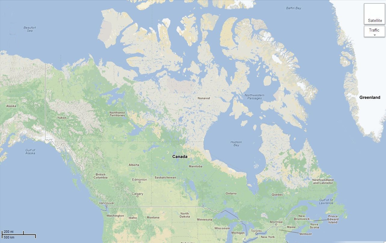
Part 2 - Provinces and Territories
Alberta British Columbia Manitoba New Brunswick Newfoundland and Labrador Nova Scotia Ontario Prince Edward Island Quebec Saskatchewan Northwest Territory Nunavut Territory Yukon Territory

Source Google Maps
Part 1 - Colonization and Historical Background
Canada is a North American country consisting of ten provinces and three territories. Located in the northern part of the continent, it extends from the Atlantic to the Pacific and northward into the Arctic Ocean. Canada is the world's second-largest country by total area, and its common border with the United States is the world's longest land border.
Beginning in the late 15th century, British and French colonial expeditions explored, and later settled, the region's Atlantic coast. France ceded nearly all of its colonies in North America to Britain in 1763 after the Seven Years' War. In 1867, with the union of three British North American colonies through Confederation, Canada was formed as a federal dominion of four provinces. This began an accretion of provinces and territories and a process of increasing autonomy, culminating in the Canada Act 1982.
Canada is a federal state governed as a parliamentary democracy and a constitutional monarchy, with Queen Elizabeth II as its head of state. The country is officially bilingual. (English and French).
The first known attempt at European colonization began when Norsemen settled briefly at L'Anse aux Meadows in Newfoundland around 1000 AD. No further European exploration occurred until 1497, when Italian seafarer John Cabot explored Canada's Atlantic coast for England. Basque and Portuguese mariners established seasonal whaling and fishing outposts along the Atlantic coast in the early 16th century. In 1534, French explorer Jacques Cartier explored the St. Lawrence River and took possession of the territory in the name of King Francis I of France.
In 1583, Sir Humphrey Gilbert claimed St. John's, Newfoundland, as the first North American English colony by the royal prerogative of Queen Elizabeth I. French explorer Samuel de Champlain arrived in 1603, and established the first permanent European settlements at Port Royal in 1605 and Quebec City in 1608. French colonists of New France, extensively settled the St. Lawrence River valley and the present-day Maritimes, while fur traders and Catholic missionaries explored the Great Lakes, Hudson Bay, and the Mississippi watershed to Louisiana.
The English established additional colonies in Cupids and Ferryland, Newfoundland, beginning in 1610. The Thirteen Colonies to the south were founded soon after. Mainland Nova Scotia came under British rule with the 1713 Treaty of Utrecht; the Treaty of Paris (1763) ceded Canada and most of New France to Britain after the Seven Years' War.
The Royal Proclamation of 1763 created the Province of Quebec out of New France, and annexed Cape Breton Island to Nova Scotia. St. John's Island (now Prince Edward Island) became a separate colony in 1769. To avert conflict in Quebec, the British passed the Quebec Act of 1774, expanding Quebec's territory to the Great Lakes and Ohio Valley. It re-established the French language, Catholic faith, and French civil law there. This angered many residents of the Thirteen Colonies, fueling anti-British sentiment in the years prior to the 1775 outbreak of the American Revolution.
The 1783 Treaty of Paris recognized American independence and ceded territories south of the Great Lakes to the United States. New Brunswick was split from Nova Scotia as part of a reorganization of Loyalist settlements in the Maritimes. To accommodate English-speaking Loyalists in Quebec, the Constitutional Act of 1791 divided the province into French-speaking Lower Canada (later Quebec) and English-speaking Upper Canada (later Ontario), granting each its own elected legislative assembly.
The Canadas were the main front in the War of 1812 between the United States and Britain. Following the war, large-scale immigration to Canada from Britain and Ireland began in 1815. Between one-quarter and one-third of all Europeans who immigrated to Canada before 1891 died of infectious diseases.
The Act of Union 1840 merged the Canadas into a united Province of Canada. Responsible government was established for all British North American provinces by 1849. The signing of the Oregon Treaty by Britain and the United States in 1846 ended the Oregon boundary dispute, extending the border westward along the 49th parallel. This paved the way for British colonies on Vancouver Island (1849) and in British Columbia (1858)
Following several constitutional conferences, the 1867 Constitution Act officially proclaimed Canadian Confederation on July 1, 1867, initially with four provinces – Ontario, Quebec, Nova Scotia, and New Brunswick. Canada assumed control of Rupert's Land and the North-Western Territory to form the Northwest Territories. The province of Manitoba was created in July 1870. British Columbia and Vancouver Island (which had been united in 1866) joined the Confederation in 1871, while Prince Edward Island joined in 1873.
To open the West, the government sponsored the construction of three transcontinental railways (including the Canadian Pacific Railway), opened the prairies to settlement with the Dominion Lands Act, and established the North-West Mounted Police to assert its authority over this territory. In 1898, during the Klondike Gold Rush in the Northwest Territories, the Canadian government created the Yukon Territory. Continental European immigrants settled the prairies, and Alberta and Saskatchewan became provinces in 1905.
The Dominion of Newfoundland (now Newfoundland and Labrador) was unified with Canada in 1949.
Although most Canadians accept their national identity as Canada, the Province of Quebec which is predominately French both in language and culture has demonstrated, sometimes violently, for autonomy as a separate nation.
Part 2 - Provinces and Territories
The provinces of Canada are Alberta, British Columbia, Manitoba, New Brunswick, Newfoundland and Labrador, Nova Scotia, Ontario, Prince Edward Island, Quebec, and Saskatchewan. The three territories are Northwest Territories, Nunavut, and Yukon.
 Alberta was established as a province on September 1, 1905. After the British arrival in Canada, approximately half of the province of Alberta, south of the Athabasca River drainage, became part of Rupert's Land which consisted of all land drained by rivers flowing into Hudson Bay. This area was granted by Charles II of England to the Hudson's Bay Company (HBC) in 1670, and rival fur trading companies were not allowed to trade in it. After the arrival of French Canadians in the west around 1731, they settled near fur trading posts. The Athabasca River and the rivers north of it were not in HBC territory because they drained into the Arctic Ocean instead of Hudson Bay, and they were prime habitat for fur-bearing animals. Fur traders formed the North West Company (NWC) of Montreal to compete with the HBC in 1779. The NWC occupied the northern part of Alberta territory. Sir Alexander Mackenzie, followed the North Saskatchewan River to its northernmost point near Edmonton, then setting northward on foot, trekked to the Athabasca River, which he followed to Lake Athabasca. It was there he discovered the mighty outflow river which bears his name—the Mackenzie River—which he followed to its outlet in the Arctic Ocean. Returning to Lake Athabasca, he followed the Peace River upstream, eventually reaching the Pacific Ocean, and so he became the first white man to cross the North American continent north of Mexico. The extreme southernmost portion of Alberta was part of the French (and Spanish) territory of Louisiana, sold to the United States in 1803; in 1818, the portion of Louisiana north of the Forty-Ninth Parallel was ceded to Great Britain. Northern Alberta was included in the North-Western Territory until 1870, when it and Rupert's land became Canada's Northwest Territories. The district of Alberta was created as part of the North-West Territories in 1882.
 British Columbia As well as being the westernmost province of Western Canada, British Columbia is also a component of the Pacific Northwest, along with the US states of Oregon and Washington. The arrival of Europeans began around the mid-18th century, as fur traders entered the area to harvest sea otters. While it is thought that Sir Francis Drake may have explored the British Columbian coast in 1579, it was Juan Pérez who completed the first documented voyage, which took place in 1774. Juan Francisco de la Bodega y Quadra explored the coast in 1775. In doing so, Pérez and Quadra reasserted the Spanish claim for the Pacific coast, first made by Vasco Núñez de Balboa in 1513. The explorations of James Cook in 1778 and George Vancouver in 1792-93 established British jurisdiction over the coastal area north and west of the Columbia River. In 1794, by the third of a series of agreements known as the Nootka Conventions, Spain conceded its claims of exclusivity in the Pacific. This opened the way for formal claims and colonization by other powers, including Britain, but because of the Napoleonic Wars there was little British action on its claims in the region until later. The establishment of trading posts under the auspices of the North West Company and the Hudson's Bay Company (HBC), effectively established a permanent British presence in the region. The Columbia District, broadly defined as being south of 54°40 north latitude, (the southern limit of Russian America) and north of Mexican Controlled California west of the Rocky Mountains was, by the Anglo-American Convention of 1818, under the "joint occupancy and use" of citizens of the United States and subjects of Britain (which is to say, the fur companies). This co-occupancy was ended with the Oregon Treaty of 1846.
 Manitoba Fur traders first arrived during the late 17th century. Manitoba became a province of Canada in 1870 after the Red River Rebellion. In 1611, Henry Hudson was one of the first Europeans to sail into what is now known as Hudson Bay, where he was abandoned by his crew. The first European to reach present-day central and southern Manitoba was Sir Thomas Button, who travelled upstream along the Nelson River to Lake Winnipeg in 1612 in an unsuccessful attempt to find and rescue Hudson. The Nonsuch, a British ship, sailed into Hudson Bay in 1668–1669, becoming the first trading vessel to reach the area; that voyage led to the formation of the Hudson's Bay Company, which was given absolute control of the entire Hudson Bay watershed by the British government. This watershed was named Rupert's Land, after Prince Rupert, who helped to subsidize the Hudson's Bay Company. Pierre Gaultier de Varennes, sieur de La Vérendrye, visited the Red River Valley in the 1730s to help open the area for French exploration and trade. As French explorers entered the area, a Montreal-based company, the North West Company, began trading with the Métis. Both the North West Company and the Hudson's Bay Company built fur-trading forts; the two companies competed in southern Manitoba, occasionally resulting in violence, until they merged in 1821. Great Britain secured the territory in 1763 as a result of their victory over France in the Seven Years' War.
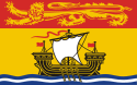 New Brunswick is one of Canada's three Maritime provinces and is the only province in the federation that is constitutionally bilingual (English–French). Although it is possible that Vikings may have reached as far south as New Brunswick, the first known European exploration of New Brunswick was that of French explorer Jacques Cartier in 1534, who discovered and named the Bay of Chaleur. The next French contact was in 1604, when a party led by Pierre du Gua de Monts and Samuel de Champlain set up camp for the winter on St.Croix Island, between New Brunswick and Maine. The colony relocated the following year across the Bay of Fundy to Port Royal, Nova Scotia. Over the next 150 years, a number of other French settlements and seigneuries were founded in the area occupied by present-day New Brunswick, including along the St. John River, the upper Bay of Fundy region, in the Tantramar Marshes at Beaubassin, and finally at St. Pierre (site of present day Bathurst). The whole maritime region (as well as parts of Maine) was at that time claimed by France and was designated as the colony of Acadia. One of the provisions of the Treaty of Utrecht of 1713 was the surrender of peninsular Nova Scotia to the British. The bulk of the Acadian population thus found themselves residing in the new British colony of Nova Scotia. During the French and Indian War (1754–63), the British completed their conquest of Acadia and extended their control to include all of New Brunswick. After the Seven Years' War, most of present day New Brunswick (and parts of Maine) were absorbed into the colony of Nova Scotia and designated as Sunbury County. New Brunswick's relatively isolated location on the Bay of Fundy, away from the Atlantic coastline proper tended to discourage settlement during the postwar period. The northwestern border between Maine and New Brunswick had not been clearly defined by the Treaty of Paris (1783) that had ended the American Revolution. By the late 1830s, population growth and competing lumber interests in the upper Saint John River valley created the need for a definite boundary in the area. During the winter of 1838–39, the situation quickly deteriorated, with both Maine and New Brunswick calling out their respective militias. The "Aroostook War" was bloodless (but politically very tense), and the boundary was subsequently settled by the Webster-Ashburton Treaty of 1842.
 Newfoundland and Labrador is the easternmost province of Canada. Situated in the country's Atlantic region, it incorporates the island of Newfoundland and mainland Labrador to the northwest. The oldest confirmed accounts of European contact date from a thousand years ago as described in the Viking (Norse) Icelandic Sagas. Archaeological evidence of a Norse settlement was found in L'Anse aux Meadows, Newfoundland. There are several other unconfirmed accounts of European discovery and exploration. One tale by men from the Channel Islands being blown off course in the late 15th century into a strange land full of fish, and another from Portuguese maps that depict the Terra do Bacalhau, or land of codfish, west of the Azores. The earliest, though, is the Voyage of Saint Brendan, the account of an Irish monk who wrote fantastical accounts of a voyage made in the early 6th century. While the story itself became a part of myth and legend, some historians believe it is based on fact.In 1496 John Cabot obtained a charter from English King Henry VII to "sail to all parts, countries and seas of the East, the West and of the North, under our banner and ensign and to set up our banner on any new-found-land" and on 24 June 1497 landed in Cape Bonavista. In 1499 and 1500, Portuguese mariners João Fernandes Lavrador and Pêro de Barcelos explored and mapped the coast, the former's name appearing as "Labrador" on topographical maps of the period. Based on the Treaty of Tordesillas, the Portuguese Crown claimed it had territorial rights in the area visited by John Cabot in 1497 and 1498. Subsequently, in 1501 and 1502 the Corte-Real brothers explored Newfoundland and Labrador, claiming them as part of the Portuguese Empire. In 1506, king Manuel I of Portugal created taxes for the cod fisheries in Newfoundland waters. João Álvares Fagundes and Pêro de Barcelos established fishing outposts in Newfoundland and Nova Scotia around 1521, but older Portuguese settlements are known to exist, being in fact the first permanent settlements in mainland America. Sir Humphrey Gilbert, provided with letters patent from Queen Elizabeth I, landed in St John's in August 1583, and formally took possession of the island. In 1583 Newfoundland became England's first possession in North America and one of the first permanent English colonies in the New World. Though English fishing boats had visited Newfoundland continuously since Cabot's second voyage in 1498 and seasonal fishing camps had existed for a century prior, similar was true of French, Portuguese, and Basque ships and camps, thus pressure to secure the island from foreign control led to the appointment of Proprietary Governors to establish colonial settlements on the island from 1610 to 1728. Newfoundland remained a colony until acquiring Dominion status in 1907.
 Nova Scotia In 1604, French colonists established the first permanent European settlement in Canada and the first north of Florida at Port Royal, founding what would become known as Acadia. The British Conquest of Acadia took place in 1710. It was formally recognized in 1713 by the Treaty of Utrecht. Cape Breton Island (Île Royale) was returned to the French in the Treaty of Utrecht. What is now New Brunswick was still a part of the French colony of Acadia. The name of the capital was changed from Port Royal to Annapolis Royal, Nova Scotia. The capital of Nova Scotia was changed from Annapolis Royal to the newly established Halifax in 1749. In 1755, the vast majority of the French population (the Acadians) were expelled and replaced by New England Planters who arrived between 1759-1768. In 1763, most of Acadia (Cape Breton Island, St. John's Island (now Prince Edward Island) and New Brunswick) became part of Nova Scotia. In 1769, St. John's Island became a separate colony. Nova Scotia included present-day New Brunswick until that province was established in 1784 after the arrival of United Empire Loyalists. In 1867 Nova Scotia was one of the four founding provinces of the Canadian Confederation. Nova Scotia was the first colony in British North America and in the British Empire to achieve responsible government in January–February 1848.
 Ontario Samuel de Champlain reached Lake Huron in 1615, and French missionaries began to establish posts along the Great Lakes. French settlement was hampered by their hostilities with the Iroquois, who allied themselves with the British. The British established trading posts on Hudson Bay in the late 17th century and began a struggle for domination of Ontario. The 1763 Treaty of Paris ended the Seven Years' War by awarding nearly all of France's North American possessions (New France) to Britain. The region was annexed to Quebec in 1774. From 1783 to 1796, the Kingdom of Great Britain granted United Empire Loyalists leaving the United States following the American Revolution land and other items with which to rebuild their lives. This measure substantially increased the population of Canada west of the St. Lawrence-Ottawa River confluence during this period, a fact recognized by the Constitutional Act of 1791, which split Quebec into the Canadas: Upper Canada southwest of the St. Lawrence-Ottawa River confluence, and Lower Canada east of it. Land was not legally subdivided into administrative units until a treaty had been concluded with the native peoples ceding the land. In 1788, while part of the Province of Quebec (1763–1791), southern Ontario was divided into four districts: Hesse, Lunenburg, Mecklenburg, and Nassau.In 1792, the four districts were renamed: Hesse became the Western District, Lunenburg became the Eastern District, Mecklenburg became the Midland District, and Nassau became the Home District. Counties were created within the districts. By 1798, there were eight districts: Eastern, Home, Johnstown, London, Midland, Newcastle, Niagara, and Western. By 1826, there were eleven districts: Bathurst, Eastern, Gore, Home, Johnstown, London, Midland, Newcastle, Niagara, Ottawa, and Western. By 1838, there were twenty districts: Bathurst, Brock, Colbourne, Dalhousie, Eastern, Gore, Home, Huron, Johnstown, London, Midland, Newcastle, Niagara, Ottawa, Prince Edward, Simcoe, Talbot, Victoria, Wellington, and Western. In 1849, the districts of southern Ontario were abolished by the Province of Canada, and county governments took over certain municipal responsibilities. The Province of Canada also began creating districts in sparsely populated Northern Ontario with the establishment of Algoma District and Nipissing District in 1858. The borders of Ontario, its new name in 1867, were provisionally expanded north and west. When the Province of Canada was formed, its borders were not entirely clear, and Ontario claimed to eventually reach all the way to the Rocky Mountains and Arctic Ocean. With Canada's acquisition of Rupert's Land, Ontario was interested in clearly defining its borders, especially since some of the new areas it was interested in were rapidly growing. After the federal government asked Ontario to pay for construction in the new disputed area, the province asked for an elaboration on its limits, and its boundary was moved north to the 51st parallel north. The northern and western boundaries of Ontario were in dispute after Canadian Confederation. Ontario's right to Northwestern Ontario was determined by the Judicial Committee of the Privy Council in 1884 and confirmed by the Canada (Ontario Boundary) Act, 1889 of the Parliament of the United Kingdom. By 1899, there were seven northern districts: Algoma, Manitoulin, Muskoka, Nipissing, Parry Sound, Rainy River, and Thunder Bay. Four more northern districts were created between 1907 and 1912: Cochrane, Kenora, Sudbury and Timiskaming.
 Prince Edward Island is a Canadian province consisting of an island of the same name, as well as other islands. The maritime province is the smallest in the nation in land area. In 1534, Jacques Cartier was the first European to see the island. As part of the French colony of Acadia, the island was called "Île Saint-Jean". Roughly one thousand Acadians lived on the island, many of whom had fled to the island from mainland Nova Scotia during the first wave of the British-ordered expulsion in 1755, reaching a population of 5,000. However, many more were forcibly deported during the second wave of the expulsion after the Siege of Louisbourg (1758). In the Ile Saint-Jean Campaign (1758) General Jeffery Amherst ordered Colonel Andrew Rollo to capture the island. Many Acadians died in the expulsion en route to France. Great Britain obtained the island from France under the terms of the Treaty of Paris in 1763 which settled the Seven Years' War. The British called their new colony St. John's Island (also the Island of St. John's).
 Quebec is the only Canadian province with a predominantly French-speaking population and the only one whose sole official language is French at the provincial level. Quebec is Canada's largest province by area. The first French explorer to reach Quebec was Jacques Cartier, who planted a cross in 1534 at either Gaspé or Old Fort Bay on the Lower North Shore. He sailed into the St. Lawrence River in 1535 and established an ill-fated colony near present-day Quebec City at the site of Stadacona, a village of the St. Lawrence Iroquoians. The province of Quebec extended into the Ohio Valley. The area was part of New France and eventually came under British control. The New England colonies invaded without success during the American Revolution and afterwards New France lost much its territory in what would become the United States. The French and British could not co-exist and Quebec was divided into Lower Canada and Upper Canada in 1787 with separate governments for the French and British. Rebellion continued through the early 1800's. in 1867 the Parliament of the United Kingdom passed the British North America Act, providing for the Confederation of most of the provinces. The former Province of Canada was divided into its two previous parts as the provinces of Ontario (Upper Canada) and Quebec (Lower Canada). New Brunswick and Nova Scotia joined Ontario and Quebec in the new Dominion of Canada. The other provinces then joined the Confederation, one after the other: Manitoba and the Northwest Territories in 1870, British Columbia in 1871, Prince Edward Island in 1873, Yukon in 1898, Alberta and Saskatchewan in 1905, Newfoundland in 1949 and finally Nunavut in 1999.
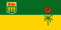 Saskatchewan was first explored by Europeans in 1690 and settled in 1774, having also been inhabited for thousands of years by various indigenous groups. It became a province in 1905. In 1803 the Louisiana Purchase transferred from France to the United States part of what is now Alberta and Saskatchewan. In 1818 it was ceded to the United Kingdom. Most of what is now Saskatchewan, though, was part of Rupert's Land and controlled by the Hudson's Bay Company, which claimed rights to all watersheds flowing into Hudson Bay, including the Saskatchewan, Churchill, Assiniboine, Souris, and Qu'Appelle River systems. In 1870, Canada acquired the Hudson's Bay Company's territories and formed the North-West Territories to administer the vast territory between British Columbia and Manitoba. The Crown also entered into a series of numbered treaties with the indigenous peoples of the area, which serve as the basis of the relationship between First Nations, as they are called today, and the Crown. Since the late twentieth century, land losses and inequities as a result of those treaties have been subject to negotiation for settlement between the First Nations in Saskatchewan and the federal government, in collaboration with provincial governments.
 Northwest Territory Located in northern Canada, the territory borders Canada's two other territories, Yukon to the west and Nunavut to the east, and three provinces: British Columbia to the southwest, and Alberta and Saskatchewan to the south. The present-day territory was created in June 1870, when the Hudson's Bay Company transferred Rupert's Land and North-Western Territory to the government of Canada. This immense region comprised all of non-confederation Canada except British Columbia, the coast of the Great Lakes, the Saint Lawrence River valley and the southern third of Quebec, the Maritimes, Newfoundland, and the Labrador coast. It also excluded the Arctic Islands except the southern half of Baffin Island; these remained under direct British claim until 1880. After the transfer, the territories were gradually whittled away. The province of Manitoba was created on July 15, 1870, a tiny square around Winnipeg, and then enlarged in 1881 to a rectangular region composing the modern province's south. By the time British Columbia joined Confederation on July 20, 1871, it had already (1866) been granted the portion of North-Western Territory south of 60 degrees north and west of 120 degrees west, an area that had comprised most of the Stickeen Territories. In 1882, Regina in the District of Assiniboia became the territorial capital; after Alberta and Saskatchewan became provinces in 1905, Regina became the provincial capital of Saskatchewan. In 1876, the District of Keewatin, at the centre of the territory, was separated from it. In 1882 and again in 1896, the remaining portion was divided into the following districts (corresponding to the following modern-day areas):
Alberta (southern Alberta);
Assiniboia (southern Saskatchewan);
Athabasca (northern Alberta and Saskatchewan);
Franklin (the Arctic islands and Boothia and Melville Peninsulas);
Mackenzie (mainland NWT and western Nunavut);
Saskatchewan (central Saskatchewan);
Ungava (modern-day northern Quebec and inland Labrador, as well as an offshore area in Hudson Bay);
Yukon (modern Yukon).
Keewatin was returned to the Northwest Territories in 1905. In the meantime, the Province of Ontario was enlarged northwestward in 1882. Quebec was also extended northwards in 1898, and the Yukon was made a separate territory in that same year in order to deal with the Klondike Gold Rush, and also to remove the NWT's government from the burden of administering the sudden boom of population, economic activity, and the influx of non-Canadians. The provinces of Alberta and Saskatchewan were created in 1905, and Manitoba, Ontario, and Quebec acquired the last of their modern territories from the NWT in 1912. This left only the districts of Mackenzie, Franklin (which absorbed the remnants of Ungava in 1920), and Keewatin. In 1925, the boundaries of the NWT were extended all the way to the North Pole on the sector principle, vastly expanding its territory onto the northern ice cap. The reduced Northwest Territories was not represented in the Canadian House of Commons from 1907 until 1947, when the electoral district of Yukon—Mackenzie River was created. This riding only included the District of Mackenzie. The rest of the Northwest Territories had no representation in the House of Commons until 1962, when the Northwest Territories electoral district was created in recognition of the Inuit having been given the right to vote in 1953. In 1912, the Parliament of Canada made the official name of these territories the Northwest Territories, dropping all hyphenated forms of it. On April 1, 1999, the eastern three-fifths of the Northwest Territories (including all of the District of Keewatin and much of that of Mackenzie and Franklin) became a separate Canadian territory named Nunavut.
 Nunavut comprises a major portion of Northern Canada, and most of the Canadian Arctic Archipelago. Its vast territory makes it the fifth-largest country subdivision in the world, as well as the largest in North America. It is the only geo-political region of Canada that is not connected to the rest of North America by highway. Nunavut is both the least populous and the largest in area of the provinces and territories of Canada. One of the most remote, sparsely settled regions in the world, it has a population of 31,906, mostly Inuit, spread over an area the size of Western Europe. Nunavut is also home to the northernmost permanently inhabited place in the world, Alert. Nunavut's Chief Executive is a Commissioner appointed by the federal Minister of Indian Affairs and Northern Development.
 Yukon was created from the rump of the Hudson's Bay Company's North-Western Territory in 1898. Yukon's historical major industry has been mining (lead, zinc, silver, gold, asbestos and copper). The government acquired the land from the Hudson's Bay Company in 1870 and split it from the Northwest Territories in 1898 to fill the need for local government created by the population influx of the gold rush. Thousands of these prospectors flooded the territory, creating a colorful period recorded by authors such as Robert W. Service and Jack London. The memory of this period and the early days of the Royal Canadian Mounted Police, as well as the territory's scenic wonders and outdoor recreation opportunities, makes tourism the second most important industry.
- Related Topics